

Reservoir Reoperation
The infrastructure built in our basins (reservoirs, canals, levees, bypasses, flood plains treatment plants, groundwater pumps) was not designed to meet competing water uses for anthropogenic and environmental requirements. How to get the most out of the current infrastructure? In this research we explore ways to re-operate reservoirs to balance these competing uses, the methods used are basin simulation and optimization methods. We have explored 2 case of studies: the Rio Grande/Rio Bravo, a transboundary basin between the United States and Mexico and the Leishui River in China. In the Rio Grande/Bravo case, we are involved in a multidisciplinary team to develop strategies to provide environmental flows through the Big Bend, a reach located along the Rio Grande mainstem. The objective of this project is to design reservoir operation policies to reconcile human and environmental needs.
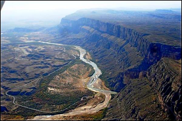
Reservoir Re-operation for Environmental Flows in the Big Bend Reach of the Rio Grande/Bravo
by Samuel Sandoval Solis and Belize A. Lane
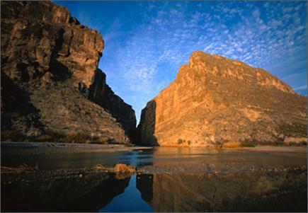
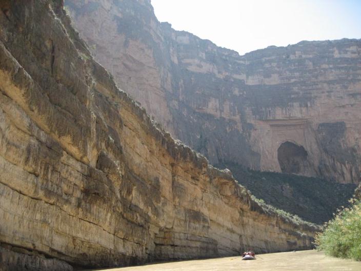
Sustainable water systems are those designed to meet present and future water demands while maintaining the range of hydrologic variation necessary to preserve the ecological integrity of the basin. Achieving sustainable water management in transboundary basins is particularly challenging due to the existence of international agreements, inconsistent regulations and authorities that often do not consider the environment as an integral part of water resources management. The Big Bend Reach of the Rio Grande/Bravo (RGB) Basin, a highly water-stressed transboundary river basin shared by the United States (U.S.) and Mexico, provides a fascinating case study for the development of integrative water resources management in a complex but data-rich system with over-allocated water resources and heavily degraded ecosystems.
 |
 |
| From Here | To Here |
The Big Bend - which consists of the Mexican Rio Conchos from Luis L. Leon (LLL) Reservoir to its confluence with the RGB mainstem and down the mainstem to international Amistad Reservoir - has been declared a region of environmental and economic significance to both countries due to the fragility and uniqueness of its ecosystems as well as its economic significance for agriculture, flood control and tourism (Obama and Calderon-Hinojosa 2010). This region contains riparian and aquatic ecosystems unique to the arid southwest as well as habitat for numerous endangered and endemic species, including over 12,000 km2 of protected natural areas on both sides of the border. Together with population growth and climate change, water resources management activities for flood control and water supply have altered the local hydrologic regime and ecological processes, leading to significant environmental degradation. Indicators of the failure of the current flow regime in the Big Bend Reach include the out-competition of native species by exotics, e.g. salt cedar (Tamarix spp) and giant cane (Arundo donax) (Everitt 1998), the failure to meet water quality standards (URG BBEST 2012) and the near complete extinction of endemic riverine species, e.g. Rio Grande silvery minnow (Hybognathus amarus) (Bestgen and Platania 1991). Despite scientific recognition of streamflow regulation as a key driver of river ecosystem degradation, no environmental water management policy currently exists for the BB Reach.
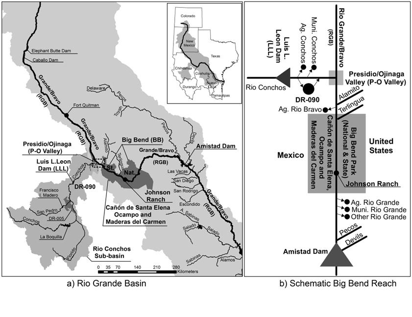
Water in the Big Bend is subject to many competing human uses, including municipal, irrigation and industrial water supply, international water allocation agreements, downstream demands and flood protection. Despite the over-allocation of water resources, hydraulic infrastructure and the lack of an integrative water policy provide an opportunity to improve environmental water management while continuing to meet the basin’s human constraints. While numerous strategies have been explored to improve environmental conditions in the Big Bend, re-operating LLL Reservoir to provide environmental flows is among the top contenders for three reasons: (1) the required water volume already exists (over 70% of streamflow through the BB Reach comes through LLL from the Rio Conchos) but the timing is not currently optimized for environmental purposes, (2) the reservoir infrastructure already exists to deliver e-flows and is located just upstream of the ecologically degraded region, and (3) water for the environment is not necessarily a consumptive use because it can be re-captured downstream at Amistad Reservoir (URG BBEST 2012).
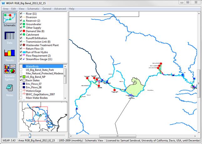
In order to address the potential for reservoir re-operation, a Big Bend Reach Water Planning Simulation Model was built to evaluate stakeholder-driven scenarios for integrative water management for humans and the environment. The model uses the WEAP software platform to integrate a one-dimensional hydrologic model with a priority-based water management model in order to represent the regional hydrology, infrastructure and water allocation systems (Yates et al. 2005). It calculates a monthly mass balance of inflows, change in reservoir storage, water demands and outflows over a 55-year period of hydrologic analysis (1955 – 2009).
The simulation model was used to simulate current regional water management and alternative re-operation scenarios to provide environmental flows to the Big Bend based on the natural flow paradigm. The natural flow paradigm considers five components of the natural (pre- reservoir regulated) flow regime critical to regulating ecological processes in river ecosystems: magnitude, frequency, duration, timing and rate of change of streamflow (Poff and Ward, 1989). These components were estimated through a probabilistic streamflow analysis using the IHA method in order to characterize the full range of flows and hydrologic phenomena critical to the integrity of the riverine ecosystems (Sandoval-Solis et al. 2010). This analysis was used to develop annual and sub-annual environmental (e-) flows hydrographs of average monthly environmental water volume requirements at a high-risk location. The model was then used to explore alternative water allocation policies (including e-flows recommendations and reservoir operation parameters {i.e. monthly top of conservation, drought storage and flood storage capacity thresholds}), using an iterative simulation process to estimate the maximum volume of water available in the system for the environment. Results indicate that the maximum amount of water that can be supplied to the BB Reach at Johnson Ranch without affecting other water users, treaty obligations, or increasing regional flood risk is 982 million m3/year, or 66% of the pre-reservoir alteration conditions (Sandoval-Solis 2012).
A more recent study by Lane and Sandoval (in press) expands on the identification of an upper bound of environmental water availability to determine an optimal integrative e-flows policy within the feasible solution space defined by the human context of the basin. Independent e-flows recommendations were developed based on the statistical hydrologic analysis proposed by the natural flow paradigm (Poff and Ward, 1989) coupled with an empirical ecological, hydrologic, and geomorphic overlay developed by regional experts (Upper Rio Grande Basin and Bay Expert Science Team 2012). E-flows hydrographs consisting of base and high flow components were created for three locations along the Big Bend Reach under normal and drought climatic conditions. These “ecologically calibrated” e-flows hydrographs were input into the simulation model and the sustainability of the water system for both humans and the environment was evaluated based on the relative reliability, resilience and vulnerability under alternative policy scenarios. By explicitly and scientifically coupling sub-basin scale human and environmental needs, we were able to identify water management policies with the ability to simultaneously increase the sustainability of human water constraints and improve ecosystem functions.
Results show that, by changing the timing but not the average annual volume of releases from LLL Reservoir, water allocation can be re-imagined to provide for the environmental needs of the Big Bend without significantly impacting municipal, agricultural, treaty or flood control water obligations. The proposed reservoir re-operation policy actually increases the overall water supply sustainability for all water users in the U.S. and Mexico to 100% while simultaneously reducing flood risk from the historic 18.2% to 14.5%. The policy would deliver the historical volume of water in the same timing from the Rio Conchos to meet Mexico’s treaty obligations to the U.S. Furthermore, water released from LLL Reservoir would still be recaptured in Amistad Reservoir where it can be stored and redistributed without affecting downstream water users. Ecologically, only 35% of the average un-regulated hydrograph, or 527 million m3/year, would be provided specifically for the environment, but with streamflow timing and duration to optimize particular ecosystem functions as determined by regional scientific experts.


